Camino Inglés (English Way)
Ferrol to Santiago · the shortest of the major Caminos
Part of the Camino de Santiago.
The shortest of the major Caminos to Santiago de Compostela, walked since the medieval period by English, Irish, Scandinavian, and Flemish pilgrims who arrived by sea at the Galician ports of Ferrol and A Coruña. The standard route from Ferrol covers approximately 112 km along the Ría de Ferrol coast, through the medieval Gothic town of Betanzos, over the Bruma highlands, and down into Santiago. Modern revival began in earnest in the 2000s; in 2025 over 30,000 pilgrims walked it.
Key Facts
| Distance | 112 km (6-stage breakdown; other sources cite 110–116 km, within normal waymarking variance) |
|---|---|
| Typical duration | 6 days (range 5–7) |
| Topology | Linear |
| Difficulty | Moderate |
| Countries | Spain |
| Elevation range | 2–410 m (total ascent 1,850 m, descent 1,620 m) |
| Start | Curuxeiras pier, Ferrol (2 m) — historic port of arrival |
| End | Santiago de Compostela (260 m) |
Elevation Profile
Stages
| # | Stage | Distance | Ascent | Descent | Difficulty | Accommodation |
|---|---|---|---|---|---|---|
| 1 | Ferrol → Neda | 12.4 km | 90 m | 110 m | Easy | Moderate |
| 2 | Neda → Pontedeume | 15.3 km | 230 m | 250 m | Easy | Moderate |
| 3 | Pontedeume → Betanzos | 19.7 km | 380 m | 350 m | Moderate | Moderate |
| 4 | Betanzos → Hospital de Bruma | 24.0 km | 560 m | 210 m | Hard | Very low |
| 5 | Hospital de Bruma → Sigüeiro | 24.5 km | 320 m | 480 m | Moderate | Low |
| 6 | Sigüeiro → Santiago de Compostela | 15.7 km | 210 m | 180 m | Easy | High |
Stage 4, Betanzos → Hospital de Bruma, is the hardest day and has the thinnest services — it is also where the historic A Coruña start path rejoins the Ferrol route.
Interior Journey
The narrative, common experiences, and reflection prompt for each stage below are editorial writing about the pilgrim experience — not measurements derived from OpenStreetMap or this route's geometry and logistics data. See docs/data-sources.md for what is, and isn't, independently sourced.
Stage 1 Ferrol → Neda
You begin where pilgrims have always begun on this route: at the water. The Curuxeiras pier in Ferrol is where medieval English, Irish, Scandinavian, and Flemish pilgrims stepped off boats and started walking south. There is no inland border to cross, no mountain pass to climb out of. The Camino Inglés begins with the smell of salt and the sound of seagulls. You leave Ferrol through the naval shipyards where the Spanish navy still builds frigates, and the path traces the south shore of the Ría de Ferrol. By midday you arrive in Neda, a quiet fishing town whose pilgrim hospital has been welcoming walkers since medieval times.
Common experiences
- Touching the water at the Curuxeiras pier before starting
- Walking past the active Navantia naval shipyards
- Looking across the Ría de Ferrol toward Mugardos on the far shore
- Shorter than expected — many pilgrims arrive in Neda by early afternoon
What does it mean to begin a journey at the edge of the sea instead of at the edge of a continent?
Stage 2 Neda → Pontedeume
Today the route starts to feel like a pilgrimage rather than a city walk. You leave the Neda waterfront, climb gently through eucalyptus and pine, cross small streams on Roman-style stone bridges. The Atlantic stays on your right and the path winds inland and back to the coast in turn. By afternoon you cross the long medieval bridge over the Río Eume into Pontedeume — a town named for that bridge, with the Torreón dos Andrade (the 14th-century keep of the Andrade family) rising above the rooftops. Pontedeume's old town is one of the better-preserved medieval centres in Galicia.
Common experiences
- Finding a walking pace that the body can sustain
- First Galician forest — eucalyptus, pine, and oak in mixed stands
- The medieval bridge into Pontedeume — built originally in the 14th century
- Discovering Pontedeume's old town with its arcaded streets
What pace does the route ask of you, and what pace did you arrive with?
Stage 3 Pontedeume → Betanzos
Today the path leaves the coast for good. Out of Pontedeume the climb is sharper than expected — eucalyptus forest, the smell of menthol, the sound of wind through tall thin trees. By midday you crest a ridge and see Galicia opening south toward Santiago. The descent into Betanzos follows the Mandeo river and brings you into one of the most-preserved medieval towns in Galicia. Betanzos is a Gothic town: three 15th-century churches anchor its streets, the old town walls partially survive, and the air smells of fried squid from the local tabernas. By tradition, pilgrims stop at the Igrexa de Santiago for a stamp before finding lodging.
Common experiences
- The sharp climb out of Pontedeume in eucalyptus forest
- First view of inland Galicia from the ridgeline
- Walking into the medieval old town through the Porta da Vila
- The Igrexa de Santiago de Betanzos with its Gothic basilica plan
- Galician fried squid (chocos) and red wine from a Betanzos taberna
When you turn away from the sea, what part of you is being asked to turn with it?
Stage 4 Betanzos → Hospital de Bruma
This is the day the Camino Inglés earns its difficulty. Twenty-four kilometres, sustained climbing, almost no services between Betanzos and Hospital de Bruma. You leave the Mandeo river valley and start working uphill through small Galician villages — Cos, Limiñón, Vilacoba — gaining four hundred metres to the highland where the historic pilgrim hospital stood. By late afternoon you reach Bruma, a place that exists for one reason: it is the meeting point of the historic Ferrol path and the historic A Coruña path. The albergue today sits on the ridge that medieval hospitalers chose because both groups of pilgrims would arrive there exhausted on the same day. You feel the convergence even now.
Common experiences
- The sustained climb out of Betanzos that does not let up
- Long stretches with no village in sight
- Hitting the wall around kilometre 18
- Arriving in Bruma in the late afternoon, the highland wind cool even in summer
- Meeting pilgrims who walked from A Coruña — they joined the route only here
What does it feel like to walk toward a place whose only purpose is to receive walkers?
Stage 5 Hospital de Bruma → Sigüeiro
From Bruma the route heads steadily south, mostly downhill, through pine and eucalyptus and small Galician hamlets. The terrain settles. The light changes — Galicia's notoriously soft, grey light gives the forest a green-blue cast. By afternoon you cross the Tambre river and enter Sigüeiro, the last town before Santiago. Many pilgrims linger here longer than they expected. Sigüeiro's pilgrim albergue is comfortable, the river is pleasant, and tomorrow Santiago waits. Some pilgrims feel a strange reluctance to finish.
Common experiences
- Long forest walking with the body finally finding its rhythm
- Crossing the Tambre river bridge into Sigüeiro
- The first pilgrims you see who are walking only the last day from Sigüeiro to Santiago
- An unexpected reluctance to finish the journey
Why is it sometimes harder to arrive than to walk?
Stage 6 Sigüeiro → Santiago de Compostela
Fifteen kilometres. The shortest day. You wake before dawn in Sigüeiro and walk south through forest in the half-light. The Galician countryside gives way to suburbs and then the suburbs give way to the old north gate of Santiago, the Porta do Camiño. You walk under the arch and the cobbled streets of the old town wrap around you and you are climbing the last small hills toward the cathedral. The Praza do Obradoiro opens like a held breath. Pilgrims from Frances, Portugués, Norte, Primitivo, Inglés all arrive in this same square, by different roads, on different days, exhausted in slightly different ways. The cathedral does not care which route you walked. It is here for all of them.
Common experiences
- Walking the last kilometres in quiet, alone or with chosen companions
- First view of the cathedral spires from the outskirts
- Entering Santiago through the Porta do Camiño on the north side
- Standing in the Praza do Obradoiro and not knowing what to do with the moment
- Receiving the Compostela at the Pilgrim's Office
- Finding a quiet bench in the cathedral garden afterward
Walking only six days is no less arrival than walking thirty. What did this short pilgrimage teach you that a longer one might not have?
Waypoints
482 logistics waypoints are tagged along the route, each with stageIndex and kmFromStart.
| Type | Count |
|---|---|
| Water sources | 85 |
| Medical (pharmacy/hospital) | 44 |
| Accommodation | 39 |
| Food (restaurant/café) | 152 |
| Transport (bus/train) | 136 |
| Supply (convenience/toilet) | 26 |
| Total | 482 |
Pilgrim Trend
Source: Solvitur Ambulando, which mirrors the Oficina del Peregrino's official statistics. 23-year series, 2003–2025. The trend grew slowly until around 2014, when international interest accelerated; the Inglés is now the fastest-growing major Camino by percentage. See docs/data-sources.md for the refresh methodology.
Tradition & Credential
Saint: Saint James the Great
The Camino Inglés takes its name from medieval pilgrims who arrived by sea at the Galician ports of Ferrol and A Coruña, primarily from England, Ireland, Scandinavia, and Flanders. The route's peak use occurred during the Hundred Years' War (1337–1453), when English pilgrims and traders accessed Galician ports under royal license. The two historic starting cities — A Coruña (closer, ~75 km) and Ferrol (further, ~112 km) — diverge but converge at Hospital de Bruma. Modern pilgrims overwhelmingly start from Ferrol because A Coruña falls below the 100 km Compostela minimum walking distance.
UNESCO status: Not independently UNESCO-inscribed.
Credential: Standard Pilgrim Credential (Credencial del Peregrino), stamped at least twice daily. From Ferrol it is ~112 km to Santiago, comfortably above the 100 km Compostela minimum; from A Coruña it is only ~75 km, which does not qualify on its own. Since December 2016, the Celtic Camino program lets A Coruña pilgrims qualify for the Compostela by walking at least 25 km on a certified Jacobean route in their home country before continuing from A Coruña. Credentials are issued at the Concatedral de San Xulián de Ferrol, the tourism office at the Curuxeiras pier, and the Confraternity of Saint James (UK).
Variants
| Variant | Distance | Status |
|---|---|---|
| Camino Inglés from A Coruña | 75 km | Metadata only — the historically older, shorter starting point, joining the Ferrol path at Hospital de Bruma. Full geometry, stages, and waypoints are planned for a future release. |
Files & CDN
The complete dataset lives at routes/camino-ingles/:
| File | Contents |
|---|---|
metadata.json | Overview, tradition, cultural, and logistics data |
route.geojson | Full-resolution route geometry — 4,823 points |
route.gpx | GPX 1.1 track for GPS apps and devices — 4,823 points |
stages.json | 6 stages, with interior journey narratives |
waypoints.geojson | 482 logistics waypoints |
stats.json | Annual pilgrim statistics, 2003–2025 |
Available via jsDelivr CDN:
https://cdn.jsdelivr.net/gh/walktalkmeditate/open-pilgrimages@v1/routes/camino-ingles/metadata.json
https://cdn.jsdelivr.net/gh/walktalkmeditate/open-pilgrimages@v1/routes/camino-ingles/route.geojson
https://cdn.jsdelivr.net/gh/walktalkmeditate/open-pilgrimages@v1/routes/camino-ingles/route.gpx
https://cdn.jsdelivr.net/gh/walktalkmeditate/open-pilgrimages@v1/routes/camino-ingles/stages.json
https://cdn.jsdelivr.net/gh/walktalkmeditate/open-pilgrimages@v1/routes/camino-ingles/waypoints.geojson
https://cdn.jsdelivr.net/gh/walktalkmeditate/open-pilgrimages@v1/routes/camino-ingles/stats.json
Route ID: camino-ingles
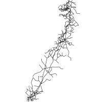
Contains information from OpenStreetMap, which is made available under the ODbL by the OpenStreetMap Foundation. This includes the route geometry, the waypoints, and the road network drawn behind the route at the top of this page.
© OpenStreetMap contributors, ODbL.