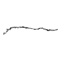
Camino del Norte (Northern Way)
Irún to Santiago · the coastal Camino
Part of the Camino de Santiago.
The coastal Camino de Santiago along the Bay of Biscay from Irún on the French border, through the Basque Country, Cantabria, Asturias, and into Galicia where it joins the Camino Francés at Arzúa for the final approach to Santiago de Compostela. Approximately 788 km in 34 native stages plus a 39 km shared run on the Francés to Santiago. Among the oldest Caminos — walked when inland Iberia was under Moorish control and the Atlantic coast remained the safer Christian corridor. The longest non-Francés Camino and the only major Camino that stays within sight of the sea for most of its length. UNESCO inscribed in 2015 as part of the Routes of Northern Spain extension.
Key Facts
| Distance | 788 km (sum of 34 native stages, Irún to Arzúa, where the Norte joins the Camino Francés; the full Irún → Santiago walk is ~820 km including the shared final section) |
|---|---|
| Typical duration | 34 days (range 30–38) |
| Topology | Linear |
| Difficulty | Hard |
| Countries | Spain |
| Elevation range | 0–710 m (total ascent 14,500 m, descent 14,450 m) |
| Start | Irún, Spain, at the French border (20 m) |
| End | Santiago de Compostela (260 m) — via Arzúa, where the Norte joins the Camino Francés |
Elevation Profile
Stages
| # | Stage | Distance | Ascent | Descent | Difficulty | Accommodation |
|---|---|---|---|---|---|---|
| 1 | Irún → San Sebastián | 24.7 km | 720 m | 735 m | Moderate | High |
| 2 | San Sebastián → Zarautz | 22.1 km | 620 m | 625 m | Moderate | High |
| 3 | Zarautz → Deba | 21.0 km | 540 m | 545 m | Moderate | Moderate |
| 4 | Deba → Markina-Xemein | 24.0 km | 820 m | 745 m | Hard | Low |
| 5 | Markina-Xemein → Gernika | 25.4 km | 620 m | 695 m | Hard | Low |
| 6 | Gernika → Lezama | 19.8 km | 580 m | 520 m | Moderate | Low |
| 7 | Lezama → Bilbao | 11.0 km | 280 m | 330 m | Easy | High |
| 8 | Bilbao → Portugalete | 19.2 km | 430 m | 420 m | Moderate | High |
| 9 | Portugalete → Castro Urdiales | 32.1 km | 640 m | 655 m | Hard | Moderate |
| 10 | Castro Urdiales → Laredo | 30.5 km | 610 m | 625 m | Hard | Moderate |
| 11 | Laredo → Güemes | 28.7 km | 540 m | 495 m | Hard | Low |
| 12 | Güemes → Santander | 18.6 km | 210 m | 250 m | Easy | High |
| 13 | Santander → Santillana del Mar | 36.3 km | 540 m | 470 m | Hard | Moderate |
| 14 | Santillana del Mar → Comillas | 22.2 km | 380 m | 440 m | Moderate | Moderate |
| 15 | Comillas → Colombres | 28.0 km | 530 m | 490 m | Hard | Moderate |
| 16 | Colombres → Llanes | 22.9 km | 380 m | 435 m | Moderate | High |
| 17 | Llanes → Ribadesella | 30.0 km | 490 m | 490 m | Hard | Moderate |
| 18 | Ribadesella → Colunga | 20.1 km | 350 m | 310 m | Moderate | Moderate |
| 19 | Colunga → Villaviciosa | 17.5 km | 330 m | 360 m | Easy | Moderate |
| 20 | Villaviciosa → Gijón | 29.8 km | 560 m | 560 m | Hard | High |
| 21 | Gijón → Avilés | 25.4 km | 320 m | 315 m | Moderate | High |
| 22 | Avilés → Muros de Nalón | 23.2 km | 500 m | 420 m | Moderate | Moderate |
| 23 | Muros de Nalón → Soto de Luiña | 15.3 km | 320 m | 380 m | Easy | Low |
| 24 | Soto de Luiña → Cadavedo | 18.5 km | 460 m | 425 m | Moderate | Low |
| 25 | Cadavedo → Luarca | 15.3 km | 360 m | 390 m | Easy | Moderate |
| 26 | Luarca → La Caridad | 30.5 km | 570 m | 490 m | Hard | Moderate |
| 27 | La Caridad → Ribadeo | 21.3 km | 380 m | 440 m | Moderate | High |
| 28 | Ribadeo → Gondán | 20.9 km | 490 m | 370 m | Moderate | Low |
| 29 | Gondán → Mondoñedo | 15.6 km | 340 m | 330 m | Moderate | Moderate |
| 30 | Mondoñedo → Abadín | 16.6 km | 580 m | 255 m | Moderate | Low |
| 31 | Abadín → Vilalba | 20.8 km | 280 m | 290 m | Moderate | Moderate |
| 32 | Vilalba → Baamonde | 18.5 km | 240 m | 290 m | Easy | Moderate |
| 33 | Baamonde → Sobrado dos Monxes | 39.8 km | 760 m | 680 m | Hard | Low |
| 34 | Sobrado dos Monxes → Arzúa (joins Camino Francés) | 22.0 km | 350 m | 470 m | Moderate | High |
Stage 33, Baamonde → Sobrado dos Monxes, is the longest single day at 39.8 km. There is no single dramatic mountain pass like the Primitivo's Puerto del Palo; the Norte's difficulty instead comes from constant short climbs and descents across coastal headlands, accumulating more total elevation gain than any other Camino in this dataset.
Interior Journey
The narrative, common experiences, and reflection prompt for each stage below are editorial writing about the pilgrim experience — not measurements derived from OpenStreetMap or this route's geometry and logistics data. See docs/data-sources.md for what is, and isn't, independently sourced.
Stage 1 Irún → San Sebastián
You begin at the Bidasoa river where France becomes Spain. Irún is quiet in the early morning and the sea is close but not yet visible. Within an hour the climb up Monte Jaizkibel has pushed the pulse into your ears and the Bay of Biscay appears below — grey or blue depending on the day, never still. The Santuario de Guadalupe above Hondarribia is where medieval pilgrims paused for the first prayer. By noon you drop into Pasaia, cross the harbour by a small passenger boat that has run for centuries, and climb again over Monte Ulía. San Sebastián reveals itself from above: the perfect arc of La Concha, the Urgull hill, the old town pressed against the water. The first day is harder than you expected. It is supposed to be.
Common experiences
- Surprise at how steep Jaizkibel is after a flat Irún morning
- The Santuario de Guadalupe at Hondarribia — the first Marian sanctuary
- Pasaia ferry — a thirty-second boat ride across the harbour mouth
- First sight of La Concha bay from Monte Ulía
- Arriving in Donostia's Parte Vieja and feeling like the Camino hasn't really started yet
You have chosen the hardest of the Caminos. What does beginning feel like when the first day already tells you the truth about what you are in for?
Stage 2 San Sebastián → Zarautz
Today is when the Basque coast becomes real. You climb out of San Sebastián past the funicular to Monte Igueldo and the Parisian-style amusement park at the top, then drop to a ridge path that alternates forest and sea views for hours. Orio smells of fried sardines. Zarautz appears as a long golden beach full of surfers — the European Surfing Championship is held here — and the old walled quarter sits at the east end above the promenade. The rhythm of the Norte is establishing itself: climb a headland, drop to a bay, cross a river, repeat.
Common experiences
- The funicular to Monte Igueldo — most pilgrims walk past rather than up
- First eucalyptus forest smell of the route
- Orio's waterfront and the smell of charcoal-grilled fish
- Zarautz beach full of surfers even in autumn
The route is settling into a pattern of climbs and bays. What rhythm did you arrive with, and does it match what the coast is asking?
Stage 3 Zarautz → Deba
If you take the coastal variant you reach the Zumaia flysch: cliffs of layered sedimentary rock pushed vertical by geological time, a UNESCO Global Geopark. The rock is the age of the dinosaur extinction and the layers read like a book. Whether you take flysch or the inland route, the day ends in Deba, a small town where the Camino crosses the Deba river on a medieval bridge and climbs into a 13th-century church with a rose window that no photograph prepares you for. The Church of Santa María de Deba was built by pilgrims for pilgrims.
Common experiences
- Getaria and Juan Sebastián Elcano — the first circumnavigator
- The flysch cliffs at Zumaia if you take the coastal variant
- The rose window at Santa María de Deba
- First time your shoulders start to accept the pack without complaint
The cliffs at Zumaia are 65 million years old. What does your tiredness feel like measured against that?
Stage 4 Deba → Markina-Xemein
Today the sea leaves you. The route turns inland and climbs into Basque farmland and mountain forest — the interior of Gipuzkoa and Bizkaia that most coastal visitors never see. Small farms with wooden balconies, cattle grazing on impossibly steep pasture, the crack of a falling chestnut in October. You will not see another pilgrim for hours. The village of Olatz is the pilgrim's oasis — two houses, a fountain, and a small albergue. By afternoon you drop into Markina-Xemein, the historical heart of the Basque pelota tradition and home to the Convento de la Merced where pilgrims still stay. The first day without the sea is harder to walk than the coastal days.
Common experiences
- Climbing above the tree line and seeing Basque mountain farms with painted wooden balconies
- The hermitage at Calvario — small, old, locked
- Olatz and its fountain — the only water on the stage
- First day without seeing the Atlantic — disorienting
- The Convento de la Merced in Markina — pilgrim albergue inside a 16th-century convent
You left the coast for a day. Did you miss it, or was the silence of the forest a gift?
Stage 5 Markina-Xemein → Gernika
You pass the Colegiata de Zenarruza, a late-medieval pilgrim church (erected as a collegiate in 1379, Gothic fabric of the 14th-15th centuries, now home to a small Cistercian community since 1988) where the scallop shell carvings on the portal have been touched by centuries of pilgrims. The path drops through Munitibar and climbs a final ridge before Gernika. And then you arrive in Gernika, which is impossible to enter without thinking of what happened here on April 26, 1937. The Casa de Juntas with its ancient oak of Gernika — a symbol of Basque liberty since medieval times, periodically renewed from the same lineage — still stands where the old tree witnessed centuries of Basque assemblies. Picasso's painting did not come from here; it came from what was destroyed. Most pilgrims take an afternoon hour at the Museo de la Paz.
Common experiences
- Touching the scallop carvings at Zenarruza
- The moment of recognition on entering Gernika — the name carries more weight than the town
- The Oak of Gernika at the Casa de Juntas — still growing, still symbolic
- Visiting the Museo de la Paz in the afternoon
You arrived at a place whose name was already in your head before you saw it. What does walking into history feel like when the history is recent?
Stage 6 Gernika → Lezama
A shorter day, by Norte standards. You climb Bizkargi through mixed forest, pass hamlets too small to appear on maps, and by early afternoon you are in Lezama, a suburban village with a pilgrim albergue, a bar, and a church. The rhythm of the past three inland days — climb, forest, village, descent, village — is about to be broken by the arrival in Bilbao tomorrow. Use the quiet of Lezama.
Common experiences
- The last forest day before Bilbao breaks the rhythm
- Small Basque hamlets with nothing open at midday
- The strange feeling of knowing tomorrow is a city day
Four days into an inland section. What is the forest teaching that the coast could not?
Stage 7 Lezama → Bilbao
A short walking day, and then Bilbao. You enter the city from above — from Mount Avril where the Guggenheim suddenly appears in the valley below, a metallic shape that looks nothing like anything else in your Camino so far. The descent is by stairs. You arrive in the Casco Viejo, the old Gothic quarter, and the rest of the day is yours. Most pilgrims take a rest day. The Guggenheim, Puente Colgante, the Cathedral, the Basílica de Begoña on the hill, tapas in Plaza Nueva — Bilbao deserves more than one night.
Common experiences
- The first glimpse of the Guggenheim from above — not what anyone expects on a pilgrimage
- The descent by stairs into the old city
- Rest-day indecision: Guggenheim or old town, pintxos or full meal
- Basílica de Begoña on the hill — the Marian heart of Biscay
You walked from an oak tree to a Frank Gehry museum in two days. What does the Camino do with that kind of contrast?
Stage 8 Bilbao → Portugalete
Today the Camino walks through the industrial memory of Biscay. The Nervión estuary was once one of Europe's major iron-producing regions — British coal came in, Basque iron went out, and the wealth of the 19th century built Bilbao. The Altos Hornos de Vizcaya blast furnaces closed in 1996. You pass their skeletons. The Puente Colgante at Portugalete is the inheritance: the world's first transporter bridge, designed by the Basque architect Alberto Palacio, completed in 1893, a UNESCO World Heritage Site since 2006. You can ride the gondola across the Ría for half a euro. Many pilgrims do — it is part of the route.
Common experiences
- Walking past the old ironworks and blast-furnace ruins
- First sight of the Puente Colgante — a surprise of Victorian engineering
- Riding the transporter gondola across the Ría
- Realizing the Camino passes through working-class industrial memory, not just cathedrals
The pilgrimage tradition and the industrial revolution usually live in different books. What does it mean to walk through both on the same afternoon?
Stage 9 Portugalete → Castro Urdiales
You cross a provincial border today but not a cultural one — the Basque-speaking world ends somewhere around Kobaron. By midday you are in Cantabria and the road signs are only in Spanish. Castro Urdiales is your reward: a perfect medieval port with a 13th-century Gothic church (Santa María de la Asunción) sitting on a rock above the harbour, looking exactly like a fortress-church should. The sun on the church at the end of a 32 km day is one of the Norte's great moments.
Common experiences
- Crossing out of the Basque Country without a sign marking it
- The fatigue that sets in at 25 km of a 32 km stage
- First sight of Santa María de la Asunción at Castro Urdiales — Gothic on a rock
- Eating anchovies (bonito or bocarte) at the Castro harbourfront — the local specialty
Three regions now — Gipuzkoa, Bizkaia, Cantabria — and you have not yet walked a thousandth of the Camino. What is the long walk teaching that a short one could not?
Stage 10 Castro Urdiales → Laredo
The Cantabrian coast is gentler than the Basque coast — softer hills, longer beaches, smaller drops between bays. But today is still 30 km and by mid-afternoon the legs are complaining. Oriñón beach is where many pilgrims take their shoes off for the first time. Liendo is a pretty valley with nothing but houses and cows. Laredo arrives as a long beachside town with a medieval walled quarter (the Puebla Vieja) at its northern end and 5 km of straight beach running south from it.
Common experiences
- Taking shoes off at Oriñón for the first beach crossing
- Liendo valley — cows and silence
- Walking the last 2 km along Laredo's promenade with the beach on one side and holiday apartments on the other
- Finding the Puebla Vieja hidden at the north end of a seemingly modern beach town
Your body is now doing something it could not do two weeks ago. What is the work of the long Camino?
Stage 11 Laredo → Güemes
Today begins with a ferry — a small boat from Laredo across the bay to Santoña, the anchovy capital of Spain. The crossing takes fifteen minutes and skips a 20 km road walk. From Santoña you climb Monte Buciero, descend to Berria beach, and spend the afternoon walking inland to Güemes. The reason to stop in Güemes is Ernesto Bustio — the 'Abuelo Peuto', a Catholic priest and traveller who has run an albergue here for decades, where pilgrims share a communal meal and a talk by Ernesto in the evening about pilgrimage, generosity, and the world. The talk is in Spanish but the ideas translate.
Common experiences
- The Laredo-Santoña ferry — the second water crossing of the Norte after Pasaia
- Anchovies in Santoña — buying a tin to take home
- Arriving at La Cabaña del Abuelo Peuto in Güemes
- The evening talk by Ernesto — an unrepeatable Camino experience
A stranger has been welcoming walkers like you for forty years. What does that kind of quiet commitment look like in your own life?
Stage 12 Güemes → Santander
A short day ending with your third ferry of the Camino — the Somo-Santander crossing, a 10-minute trip across the Bahía de Santander. Most pilgrims reach Santander by noon and have the rest of the day to wander: the Cathedral (rebuilt after the 1941 fire that burned much of the old town), the Palacio de la Magdalena (the former royal summer palace), the Paseo de Pereda waterfront. Santander's beaches are some of the best in Spain. The city is modern because of the fire, but the rhythm of a port city is ancient.
Common experiences
- Somo beach in the morning, often with surfers
- The ferry into Santander with the city skyline approaching
- A slow afternoon in a city after four long rural days
- The Cathedral's crypt — older than the rest of the cathedral by centuries
You arrived by water instead of by foot. What does entering a city by boat change about first impressions?
Stage 13 Santander → Santillana del Mar
The longest day of the Norte deserves the prettiest ending. Santillana del Mar is a medieval stone village preserved in amber — Unamuno famously called it 'the town of three lies' because it is neither holy (santa), nor flat (llana), nor on the sea (mar). But the Colegiata de Santa Juliana, a 12th-century Romanesque collegiate church with a cloister that is one of the finest in Spain, is real. The whole village is a national monument and part of the 2015 UNESCO inscription. In summer it is overrun with tourists; in April or October it is perfect.
Common experiences
- The long urban exit from Santander in the morning light
- The Mogro dilemma: train to skip the bridge-less crossing, or commit to the full 36 km
- First sight of Santillana's stone village at the end of a 10-hour day
- The Colegiata cloister in late afternoon light
- Unamuno's quote: the village of three lies
You walked 36 km to a village that is beautiful because nothing has changed in 900 years. What does preservation mean on a Camino whose whole point is movement?
Stage 14 Santillana del Mar → Comillas
Comillas is the surprise of Cantabria. El Capricho de Gaudí (1885) is one of only three Gaudí buildings outside Catalonia — a small Mudéjar-fantasy summer villa with sunflower-tile walls, built for a local indiano (a Spaniard returned rich from Cuba). It sits just below the former Pontifical Seminary, a 19th-century neo-Gothic building that housed the Comillas Pontifical University until 1969, when the university moved to Madrid. The combination of Gaudí, the Comillas town, and the Cantabrian beach is one of the Norte's least-expected reveals.
Common experiences
- The Cistercian abbey at Cóbreces — unexpected among the fields
- First sight of El Capricho through the trees
- The sunflower tiles on El Capricho's walls
- The former Pontifical Seminary looming over the beach
Gaudí and the Camino do not belong to the same century, but they share a village. What does encountering the unexpected do to the shape of a pilgrimage?
Stage 15 Comillas → Colombres
At Unquera you cross a small bridge and enter Asturias. The first town on the Asturian side is Colombres, founded by indianos — Asturians who returned from Cuba, Mexico, or Argentina with fortunes and built palatial homes in their native villages. The Archivo de Indianos (Indianos Archive) in Colombres documents this strange 19th-century diaspora and return. Before Colombres, San Vicente de la Barquera is one of the Cantabrian coast's most photogenic towns — a fortress church on a promontory above a fishing harbour, with the Picos de Europa visible inland on clear days.
Common experiences
- San Vicente de la Barquera from the long bridge into town — the fortress church silhouette
- First sight of the Picos de Europa snow-capped inland
- Crossing into Asturias at Unquera with no fanfare — just a small road sign
- The colourful indianos houses in Colombres
The indianos left Asturias poor and came back rich. What do you carry back from your own long journey?
Stage 16 Colombres → Llanes
The Asturian cliff coast is the most dramatic coastal section of the whole Camino del Norte. Between Pendueles and Vidiago you pass the bufones — blowholes where, at the right tide and sea state, the Atlantic erupts vertically out of limestone cracks in the meadow, sometimes 20 metres high. The sound is a low growl building to a boom. Llanes, at the end of the day, is a walled medieval port with a modern art installation — the Cubos de la Memoria by Agustín Ibarrola, concrete blocks painted with colours and symbols that have become the town's identity.
Common experiences
- Standing at the bufones waiting for the sea to erupt
- The old meadow walk between Pendueles and Pría, sea on the left, cows on the right
- The Cubos de la Memoria at Llanes harbour
- Cider houses (sidrerías) for the first time — the Asturian evening ritual
A blowhole is a place where what is hidden comes out with force. What have you been carrying that the Camino has not yet let loose?
Stage 17 Llanes → Ribadesella
The Playa de Gulpiyuri is 100 metres from the Atlantic but separated from it by a limestone wall. The tide enters through an underground tunnel. It is a perfect crescent of sand with waves, sitting in a meadow. You walk past it without expecting it and then you stop. Ribadesella at the end of the stage is the Sella river mouth — the Sella is the river of the Descenso del Sella, a famous international kayak race in August, and Ribadesella is where it finishes. The Tito Bustillo cave with its Paleolithic paintings (UNESCO inscribed separately) is on the far side of the bridge.
Common experiences
- Stopping at Gulpiyuri beach in disbelief
- First sight of the Sella river mouth from the cliff approach
- The bridge into Ribadesella old town in afternoon light
- Cider and fabada at a Ribadesella sidrería — the Asturian national dish
A beach inside a meadow. A cave with 15,000-year-old art. What does it mean to be surprised every day for three weeks?
Stage 18 Ribadesella → Colunga
The Asturian coast between Ribadesella and Gijón is known as the Costa Jurásica because dinosaur footprints are visible in the intertidal rocks at several beaches. MUJA (Museo del Jurásico de Asturias), on a hilltop between Colunga and Lastres, holds casts of the prints and a good dinosaur skeleton collection. If you have time, the museum is worth the short detour. The walking today is gentle — a recovery day after the Llanes-Ribadesella double.
Common experiences
- Quiet forest walking after two long days
- Dinosaur footprints visible at low tide on certain beaches
- The MUJA detour — ~1 km off the route
- Colunga's small-town calm in the evening
You are walking over 140-million-year-old footprints. What is the scale of your journey measured against that?
Stage 19 Colunga → Villaviciosa
Villaviciosa is where a Camino decision happens. Pilgrims who want to walk the Camino Primitivo branch off here, heading south to Oviedo (via the Camino del Salvador, ~30 km) and then west over the Asturian mountains to Santiago. Pilgrims continuing on the Norte go west through Gijón and Avilés. Many do not know about the decision until they arrive. The Cicerone guidebook covers both so many pilgrims carry the options with them. Villaviciosa itself is a calm Asturian town where cider (sidra, poured from above the head to aerate) is the local obsession. San Salvador de Priesca, the pre-Romanesque church just before the town, is one of the oldest intact buildings on the whole Camino.
Common experiences
- San Salvador de Priesca — 10th-century and still in use
- Arriving at Villaviciosa and realizing the Primitivo is an option
- The decision: stay on the Norte or turn south to Oviedo
- Cider poured from above the head — the Asturian escanciador tradition
A Camino fork is an old decision, older than roads. What is the logic that tells you which path to take?
Stage 20 Villaviciosa → Gijón
Gijón is the largest city in Asturias — a Roman port that became an industrial port that became a post-industrial beach town. Playa de San Lorenzo is 1.5 km of beach in the middle of the city, with the old town (Cimadevilla) on a rocky headland at one end. The Universidad Laboral is worth seeing on the outskirts — a Franco-era monument that is both beautiful and uncomfortable history. Like Bilbao, Gijón is a rest-day candidate.
Common experiences
- The long climb out of Villaviciosa through forest
- First sight of Gijón and the Playa de San Lorenzo from the ridge
- The Universidad Laboral's scale — the largest building in Spain
- Cimadevilla old town on the rocky headland
Roman port, Franco monument, post-industrial beach. What is the right way to walk through layered history in a single afternoon?
Stage 21 Gijón → Avilés
The walk from Gijón to Avilés goes through heavy industry — Arcelor-Mittal steelworks, the Aboño coal-fired power station, the port of El Musel. It is the hardest stretch of the Norte to love on first sight. And then you arrive in Avilés and the contrast is total: the old town is a medieval gem with arcaded streets, a Gothic church (San Nicolás), and the Palacio de Camposagrado. Oscar Niemeyer's bright-white cultural centre (Centro Niemeyer, 2011) sits across the ría — the great Brazilian architect's only work in Spain, commissioned when he was 99.
Common experiences
- The steelworks and power plant — unusual pilgrimage scenery
- The moment of surprise on entering Avilés old town
- The Niemeyer Centre across the Ría — bright white, curved, obviously Brazilian
- Understanding that the Camino passes through working places, not just beautiful ones
Industrial beauty is a difficult phrase. Is it a contradiction or a reality?
Stage 22 Avilés → Muros de Nalón
The last day of the big-city cluster (Bilbao, Santander, Gijón, Avilés) before the quiet western Asturian coast takes over. Salinas beach is enormous and often nearly empty — hours of walking on hard-packed sand. Muros de Nalón is a sleepy village above the river mouth where the Nalón meets the sea. The pilgrim albergue is small. The evening is quiet in a way the last few towns have not been.
Common experiences
- Salinas beach — long, wide, wind-blown
- The shift from post-industrial to rural in a single afternoon
- The Nalón river mouth from Muros
- Falling asleep to silence after nights of city noise
The Camino has a rhythm of city and silence. Which of the two asks more of you?
Stage 23 Muros de Nalón → Soto de Luiña
Cudillero is the most photographed fishing village in Asturias — a white-house amphitheatre climbing up a steep ravine from a tiny harbour. It is a tourist town now but still a working fishing port. The Camino passes through or above it depending on the variant. The day is short enough to spend an extra hour at Cudillero's harbour eating grilled octopus or arroz marinero. Soto de Luiña at the end is quiet farming country.
Common experiences
- The vertical white houses of Cudillero above the harbour
- A long lunch at a Cudillero harbourside restaurant
- Cabo Vidio cliffs in afternoon light
- The calm parish church at Soto de Luiña
A short day after many long ones is a gift. What do you do with a gift of time on a Camino?
Stage 24 Soto de Luiña → Cadavedo
The Ermita de la Regalina is one of the most photogenic chapels in Asturias — a small whitewashed hermitage on a grassy cliff above the sea, with hórreos (traditional Asturian wooden granaries on stone stilts) scattered around it. On August 29 there is a pilgrimage (romería) to the chapel with traditional Asturian music, dancing, and cider. On any other day it is quiet. Cadavedo itself is a small parish with a pilgrim albergue.
Common experiences
- First sight of the Regalina chapel on its cliff
- Hórreos scattered across the meadow around the chapel
- Sitting on the cliff with the Atlantic below
- The pilgrim dinner at the Cadavedo albergue — often communal
A small chapel on a cliff is a place people keep building. What does this kind of building stand for?
Stage 25 Cadavedo → Luarca
Luarca is a small fishing town tucked into a deep natural harbour. The Capilla de la Atalaya (16th-century watchtower chapel) and the town cemetery sit on the clifftop above the harbour — the cemetery holds the grave of Severo Ochoa, the Luarca-born Nobel laureate in physiology (1959). The town is known as 'the white village of the Green Coast' for its whitewashed fishermen's houses climbing up from the harbour. The pilgrim accommodation is good.
Common experiences
- Descending into Luarca and seeing the hidden harbour
- The clifftop chapel and cemetery at sunset
- Seafood dinner at the harbourside — Luarca is a working fishing port
- Severo Ochoa's grave — a Nobel laureate in a village cemetery
A hidden harbour, a Nobel laureate buried in his home village. What does home mean to someone who leaves and comes back?
Stage 26 Luarca → La Caridad
Tomorrow you cross into Galicia at Ribadeo. Today is the last long day of the Asturian coast. Navia is a surprisingly lively small town in the middle of the stage. Tapia de Casariego is a surf beach at the end of a long fishing harbour. La Caridad, at the end of the day, is a quiet inland parish — the Camino turns slightly inland to avoid the Ría de Ribadeo's bigger road detours. The old frontier between Asturias and Galicia has been drawing near all week and now it is tomorrow.
Common experiences
- Passing through Navia at midday — more life than most Asturian villages
- Surfers at Tapia de Casariego — unexpected in October
- Realizing that after Ribadeo the route leaves the sea for good
- Quiet evening at La Caridad — the last Asturian overnight
The coast has been your companion for nearly three weeks. How do you say goodbye to a landscape that walked with you?
Stage 27 La Caridad → Ribadeo
The Puente de los Santos crosses the Ría de Ribadeo — the Eo river mouth — from Asturias into Galicia. The bridge is 1.5 km long and was completed in 1987. Before the bridge, pilgrims crossed by ferry. Halfway across, the provincial sign marks the frontier. Ribadeo on the Galician side is a port town with a rich indiano heritage, a beach (Playa de las Catedrales is 10 km away but famous for its sea-arch formations), and the end of the Cantabrian-coastal section of the Camino. From here the route turns inland and stays inland. You say goodbye to the Atlantic here.
Common experiences
- The long walk across the Puente de los Santos — the Ría below, traffic beside
- Crossing into Galicia and seeing Galician signage for the first time (Ribadeo, not Ribadeu)
- Looking back at the Atlantic from Ribadeo's harbour for the last time
- First taste of Galician empanada or pulpo
You crossed four regions on foot in four weeks. What did each one take from you, and what did each one add?
Stage 28 Ribadeo → Gondán
The Camino turns inland for the rest of the journey. After 26 days of the Cantabrian coast, the sea is now behind you for good. The Galician interior is different from the coast — smaller villages, Celtic hórreos (wooden granaries on stone stilts, distinctive from Asturian ones), oak and chestnut forests, and the Galician language everywhere. You walk through Vilela and small Barreiros hamlets, climb a low ridge, and drop into Gondán in the late afternoon. The albergue is quiet, set beside a merendero and a small chapel dedicated to the Virgen del Pilar. A bar ~500 m away stamps credentials. The evening is the quietest of the whole Camino so far.
Common experiences
- First Galician hórreos — wooden granaries on stone stilts, different from Asturian ones
- The shift in landscape from Cantabrian coast to inland Galicia
- Galician spoken around you for the first time — a different sound from Spanish or Asturian
- The quiet of Gondán at the albergue
The sea is gone. What fills the space that the sound of the sea used to fill?
Stage 29 Gondán → Mondoñedo
Today you pass two medieval foundations in one stage. First, Vilanova de Lourenzá — the village grew up around the Benedictine Monasterio de San Salvador de Lourenzá, founded around 969 by Count Osorio Gutiérrez, the 'Conde Santo' or Holy Count, whose tomb rests inside the chapel of Valdeflores in a 6th-century Paleochristian marble sarcophagus from Aquitaine. Then, after the climb over Alto da Xesta, you descend into Mondoñedo — one of the 'seven capital cities' of Galicia, small medieval episcopal seats that together governed Galicia before the modern province of A Coruña was established. Its cathedral is 13th-century Gothic with a 15th-century cloister and a museum of medieval choir books. The local specialty is tarta de Mondoñedo, a sweet almond cake. Stop, rest, walk the cloister, buy a tarta.
Common experiences
- The San Salvador de Lourenzá monastery appearing among the fields at Vilanova de Lourenzá
- Standing in the chapel of Valdeflores at Lourenzá looking at the Holy Count's Paleochristian sarcophagus
- First Gothic cathedral since Laredo
- The Mondoñedo cloister — tiny but perfect
- Tarta de Mondoñedo at a local pastry shop
- The quiet of the medieval square in the afternoon
A small city was once a capital. What does smallness mean when it is built with weight?
Stage 30 Mondoñedo → Abadín
Today is a climb day. You leave the Mondoñedo valley and climb onto the Terra Chá — the 'flat land' of interior Galicia, a high plateau that feels more like Castile than like the Cantabrian coast. The weather changes: cooler, more wind, frequent rain. The villages thin out. Abadín is small. The evening feels like the countryside of Galicia rather than the coast of Spain. Tomorrow is Vilalba.
Common experiences
- The climb out of Mondoñedo into the plateau air
- First Galician meseta sensation — flat, windy, bright
- Small villages with nothing open at lunchtime
- The colder evening in Abadín compared to the coastal towns
The plateau is different from the coast in a way that takes a whole day to understand. What have you learned that you can only articulate in retrospect?
Stage 31 Abadín → Vilalba
Vilalba is the first town of the final week. The medieval Torre dos Andrade dominates the town — a square-plan octagonal tower from the 15th century, home of the Andrade family, now a Parador hotel where travellers sleep inside the tower walls. The last 100 km to Santiago begins around here. The albergues fill up with new pilgrims who started in Vilalba or Baamonde for the Compostela-minimum. The energy shifts: you are no longer alone. The Camino feels more like a shared project for the final week.
Common experiences
- First sight of the Torre dos Andrade rising above Vilalba
- Meeting new pilgrims who started yesterday — and remembering your first day
- The Parador in the tower — accessible but expensive
- Feeling the arrival of Santiago in the air for the first time
New pilgrims are starting the journey you are ending. What would you tell them if they asked?
Stage 32 Vilalba → Baamonde
Baamonde is the 102 km mark, just over the Compostela minimum. New pilgrims arrive here by bus today to start walking tomorrow. The tree-lined square by the Parga river is quiet, the 12th-century Romanesque church (Santiago de Baamonde — a Saint James church welcoming pilgrims walking his way) is worn and loved, and the albergue is full. The atmosphere for long-distance pilgrims is bittersweet — the end is close but so is the crowding. You are a veteran now, whether or not you knew that was coming.
Common experiences
- Seeing brand-new pilgrims arrive by bus
- The Parga river and the old bridge
- Realizing that in six days you will be in Santiago
- The crowded albergue — the first time since Laredo
You were a new pilgrim 30 days ago. What would the version of you who arrives in Baamonde by bus need from the version of you who walked here?
Stage 33 Baamonde → Sobrado dos Monxes
40 kilometres is a lot on day 33 of a pilgrimage. Most pilgrims split the stage at Miraz, where the Albergue San Martín — housed in the old parsonage and staffed by the UK Confraternity of Saint James since 2005 — is known for its kindness. Those who continue the full distance reach Sobrado dos Monxes in the late afternoon — and the reward is the monastery itself. Santa María de Sobrado was founded in 952 AD and joined the Cistercian order in 1142, making it the first Cistercian house in Spain. The monastery is still an active community of about ten monks. The pilgrim albergue is inside the monastery walls. Compline is sung at 20:00 and pilgrims are welcome to attend. The great baroque church (rebuilt in the 17th century after a fire) has a cloister and a chapter room that feel heavy with age.
Common experiences
- The decision at Baamonde: 15 km to Miraz or 40 km to Sobrado
- Albergue San Martín at Miraz with its UK-Confraternity volunteers — one of the best on the Camino
- The climb to the Serra do Careón high point at 710 m
- First sight of Sobrado's church towers above the trees
- Compline with the Cistercian community at 20:00
- Sleeping inside the monastery walls
You are staying in a house that has welcomed pilgrims for a thousand years. What do you bring to it, and what does it give back?
Stage 34 Sobrado dos Monxes → Arzúa (joins Camino Francés)
At Arzúa the Camino del Norte ends. The yellow arrows merge with the arrows of the Camino Francés and from here the two routes are one. The density of walkers triples in a single afternoon. Pilgrims who have come from Ferrol on the Inglés, from Oviedo on the Primitivo, from Irún on the Norte, from St. Jean Pied de Port on the Francés — all arrive in Arzúa within days of each other. The cafés are crowded. The albergues fill by 14:00. It can feel overwhelming after thirty quiet days on the Norte. But this is the old shape of the Camino: many rivers into one. From Arzúa it is two days to Santiago on the shared path (19.3 km to O Pedrouzo, then 19.4 km to Santiago), documented in routes/camino-frances/stages.json stages 31-32. The Norte proper ends here, at the junction.
Common experiences
- The moment the Norte arrows meet the Francés arrows
- Entering Arzúa and seeing three times as many pilgrims as yesterday
- Arzúa's famous queso — a round soft cow's-milk cheese, part of the Camino food tradition
- The strange feeling of ending a route that is not yet in Santiago
- Looking at Santiago on the map for the first time with the distance in tens of kilometres, not hundreds
Your solitary Camino has just merged with thousands of others. What does belonging feel like after so much solitude?
Waypoints
2,928 logistics waypoints are tagged along the route, each with stageIndex and kmFromStart, of which 68 are sacred sites and 51 are towns enriched from OpenStreetMap.
| Type | Count |
|---|---|
| Water sources | 662 |
| Medical (pharmacy/hospital) | 206 |
| Accommodation | 250 |
| Food (restaurant/café) | 764 |
| Transport (bus/train) | 657 |
| Supply (convenience/toilet) | 235 |
| Sacred sites | 68 |
| Towns | 51 |
| Viewpoints | 27 |
| Cultural sites | 8 |
| Total | 2,928 |
Pilgrim Trend
Source: Solvitur Ambulando, which mirrors the Oficina del Peregrino's official statistics. 23-year series, 2003–2025. The 2015 UNESCO inscription produced a small bump but did not change the route's overall demographic profile — unlike the dramatic growth seen on the Portugués Coastal over the same period. See docs/data-sources.md for the refresh methodology.
Tradition & Credential
Saint: Saint James the Great
The Camino del Norte is among the earliest Jacobean pilgrimage routes, emerging in the 9th century shortly after the discovery of the apostle's tomb at Iria Flavia. It follows segments of the old Roman Via Agrippa along the Cantabrian coast. During the 9th and 10th centuries, when much of the Iberian interior was under Moorish control, the coastal north remained under Christian rule — centred on the Kingdom of Asturias — making it the safer route for pilgrims, especially nobility arriving by ship at Cantabrian ports. With the southward Reconquista and the royal promotion of the Camino Francés from the late 11th century, the Norte declined in favour of the better-infrastructured French Way, though it remained in continuous use and was formally revived in the 20th century.
UNESCO status: World Heritage Site, inscribed 2015, as part of the “Routes of Santiago de Compostela: Camino Francés and Routes of Northern Spain” extension, which added the Camino del Norte, Primitivo, Lebaniego, and Vasco del Interior routes to the original 1993 Camino Francés inscription.
Credential: Standard Pilgrim Credential (Credencial del Peregrino), stamped at least twice daily. From Sobrado dos Monxes it is ~100 km to Santiago — the canonical last-100-km starting point — though many pilgrims walking just the minimum distance start from Vilalba (~120 km) or Baamonde (~105 km). Credentials are issued at the Parroquia de Nuestra Señora del Juncal in Irún, the Basílica de Begoña in Bilbao, and the Monasterio de Sobrado dos Monxes.
Files & CDN
The complete dataset lives at routes/camino-norte/:
| File | Contents |
|---|---|
metadata.json | Overview, tradition, cultural, and logistics data |
route.geojson | Full-resolution route geometry — 38,640 points |
route.gpx | GPX 1.1 track for GPS apps and devices — 38,640 points |
stages.json | 34 stages, with interior journey narratives |
waypoints.geojson | 2,928 logistics waypoints |
stats.json | Annual pilgrim statistics, 2003–2025 |
Available via jsDelivr CDN:
https://cdn.jsdelivr.net/gh/walktalkmeditate/open-pilgrimages@v1/routes/camino-norte/metadata.json
https://cdn.jsdelivr.net/gh/walktalkmeditate/open-pilgrimages@v1/routes/camino-norte/route.geojson
https://cdn.jsdelivr.net/gh/walktalkmeditate/open-pilgrimages@v1/routes/camino-norte/route.gpx
https://cdn.jsdelivr.net/gh/walktalkmeditate/open-pilgrimages@v1/routes/camino-norte/stages.json
https://cdn.jsdelivr.net/gh/walktalkmeditate/open-pilgrimages@v1/routes/camino-norte/waypoints.geojson
https://cdn.jsdelivr.net/gh/walktalkmeditate/open-pilgrimages@v1/routes/camino-norte/stats.json
Route ID: camino-norte
Contains information from OpenStreetMap, which is made available under the ODbL by the OpenStreetMap Foundation. This includes the route geometry, the waypoints, and the road network drawn behind the route at the top of this page.
© OpenStreetMap contributors, ODbL.