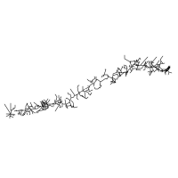
Camino Primitivo (Original Way)
Uviéu a Santiago · the original Camino, walked since 814 CE
Part of the Camino de Santiago.
The original Camino — the route walked by King Alfonso II of Asturias from Oviedo to Santiago in 814 CE shortly after the discovery of the apostle's tomb. The most physically demanding of the major Caminos, crossing the Asturian and Galician mountains via the high Hospitales/Puerto del Palo route (1,146 m), through the walled Roman city of Lugo, before joining the Camino Francés at Melide for the final descent to Santiago. UNESCO inscribed (2015 Northern Spain extension to the 1993 Camino Francés inscription).
Key Facts
| Distance | 263 km (sum of 11 native stages, Oviedo to Melide; continuing on the shared Camino Francés to Santiago adds ~53 km) |
|---|---|
| Typical duration | 11 days (range 10–13) |
| Topology | Linear |
| Difficulty | Hard |
| Countries | Spain |
| Elevation range | 76–1,146 m (total ascent 7,800 m, descent 7,770 m) |
| Start | Cathedral of San Salvador, Oviedo (232 m) |
| End | Santiago de Compostela (260 m) — via Melide, where the Primitivo joins the Camino Francés |
Elevation Profile
Stages
| # | Stage | Distance | Ascent | Descent | Difficulty | Accommodation |
|---|---|---|---|---|---|---|
| 1 | Oviedo → Grado | 25.2 km | 380 m | 540 m | Moderate | Moderate |
| 2 | Grado → Salas | 22.0 km | 720 m | 560 m | Moderate | Moderate |
| 3 | Salas → Tineo | 20.0 km | 850 m | 420 m | Hard | Moderate |
| 4 | Tineo → Pola de Allande | 28.0 km | 720 m | 870 m | Hard | Low |
| 5 | Pola de Allande → La Mesa | 21.7 km | 1,100 m | 650 m | Expert | Very low |
| 6 | La Mesa → Grandas de Salime | 16.3 km | 280 m | 640 m | Moderate | Low |
| 7 | Grandas de Salime → A Fonsagrada | 26.3 km | 950 m | 580 m | Hard | Moderate |
| 8 | A Fonsagrada → O Cádavo | 25.2 km | 530 m | 770 m | Moderate | Low |
| 9 | O Cádavo → Lugo | 30.5 km | 380 m | 640 m | Hard | Moderate |
| 10 | Lugo → San Romao da Retorta | 19.2 km | 320 m | 210 m | Easy | Low |
| 11 | San Romao da Retorta → Melide | 28.5 km | 430 m | 550 m | Moderate | Moderate |
The 30.5 km O Cádavo → Lugo stage is the longest single day on the route; many pilgrims split it at Castroverde. Day 5 (Pola de Allande → La Mesa) crosses Puerto del Palo and can optionally be swapped for the higher, more exposed Hospitales variant — not recommended in poor weather.
Interior Journey
The narrative, common experiences, and reflection prompt for each stage below are editorial writing about the pilgrim experience — not measurements derived from OpenStreetMap or this route's geometry and logistics data. See docs/data-sources.md for what is, and isn't, independently sourced.
Stage 1 Oviedo → Grado
You begin where Alfonso II began. The Cathedral of San Salvador in Oviedo was his palace church, and the Cámara Santa where you can stand today is the same 9th-century chapel he built. In 814 — within a year of the discovery of the apostle's tomb at Iria Flavia — this king walked out the cathedral doors and west into the mountains to visit the new shrine. He had no Camino Francés to follow because there was no Camino yet. He made the path. You leave Oviedo's old town through the suburbs, climb out of the river valley, and find yourself in green Asturian countryside before midday. By afternoon you cross the Nalón river and enter Grado — Grau in Asturian — a small market town with an unhurried pace that sets the tone for the route ahead.
Common experiences
- Touching the Cámara Santa before leaving Oviedo Cathedral
- Walking out through Oviedo's old town in the early light
- First Asturian forests — eucalyptus and oak in mixed stands
- Realising how green Asturias is — much greener than imagined
What does it mean to walk a path that someone else made by walking it first?
Stage 2 Grado → Salas
Today the mountains start. You leave Grado on a steady climb through small Asturian villages — Cabruñana, San Marcelo, La Doriga — each one with a stone church that has stood since the Reconquest. The forest is denser than yesterday. By midday you crest a low pass and look back east to Oviedo's distant hills. The descent into Salas is on cobbled lanes through farmhouses where elderly Asturians watch from doorways and call out 'buen camino' in accents you have never heard. Salas is a quiet medieval town with a tower house in its centre and a stone bridge over the Nonaya river.
Common experiences
- The steady climb out of Grado in the morning cool
- First small Asturian village stops — coffee from a battered espresso machine
- Realising the Primitivo is harder than expected
- Arriving in Salas tired but not exhausted
What does it feel like to be greeted by people whose accent you cannot place?
Stage 3 Salas → Tineo
Twenty kilometres of forest. The path leaves Salas and climbs slowly through chestnut groves that have stood for centuries. The Asturian forests are darker than the Galician forests you have read about — older trees, more lichen on the trunks, the kind of forest where you can imagine medieval pilgrims walking single file because the path is too narrow for two. By afternoon you climb the final approach to Tineo, a town that sits on a ridge at 673 m with views in every direction. Tineo has a famous Camino tradition: pilgrims who pass through receive a special blessing from the town's confraternity. Many stay an extra night here just to rest before the harder days ahead.
Common experiences
- The realization that you will be walking through forest for hours with no village
- Passing centuries-old chestnut trees on stone paths
- Reaching the Tineo ridge and seeing Asturias open in all directions
- The pilgrim blessing at Tineo — informal, not religious if you don't want it to be
What does it feel like to walk in a forest where humans have not been the dominant presence for thousands of years?
Stage 4 Tineo → Pola de Allande
Today is the longest day so far. Twenty-eight kilometres of mountain walking, multiple climbs, the body learning what the Primitivo really is. You leave Tineo on a forest path that climbs and descends in turn — never flat for long. Past Borres and Campiello, the route enters the high country. By the final descent into Pola de Allande your legs are arguing with you in earnest. Pola de Allande is a small town at 524 m, in a valley between two ranges. Tomorrow is the famous decision day: do you take the Hospitales variant over the high ridge, or the safer Pola de Allande route over Puerto del Palo?
Common experiences
- Deciding the night before whether to take the Hospitales variant tomorrow
- Asking the albergue host about the weather forecast for the highlands
- First seeing other pilgrims at the same dilemma
- A long evening rest in Pola de Allande, knowing tomorrow will be the route's hardest day
When the choice is between the hard scenic route and the safe ordinary route, which version of yourself chooses?
Stage 5 Pola de Allande → La Mesa
The hardest day on the hardest Camino. You climb out of Pola de Allande in the dawn cold, the air sharp at 600 m and getting sharper. Up the Puerto del Palo: 1,146 m, the roof of the Primitivo. From the pass you can see for fifty kilometres in every direction — Asturian peaks to the north, the Sierra de los Lagos to the south. Pilgrims who took the Hospitales variant at Campiello are walking the high ridge somewhere to your right, passing the ruined medieval hospitals at Paradiella, Fonfaraón, Valparaíso, Freita. Both routes converge at Berducedo and continue through forest to the small village of La Mesa, where the only albergue holds maybe twenty pilgrims. Tonight you sleep at altitude. Tonight you have crossed something.
Common experiences
- The pre-dawn start to give yourself time on the climb
- The view from Puerto del Palo — fifty kilometres in every direction
- Meeting pilgrims at Berducedo who took the other variant
- Feeling the altitude in your breathing for the first time
- The strange quiet of La Mesa at night, the wind moving through the only village for miles
What does it mean to spend a day above the everyday — and what do you bring back down with you?
Stage 6 La Mesa → Grandas de Salime
Sixteen kilometres of descending. After yesterday's climb the body is grateful. You leave La Mesa in the morning cool and drop steadily through forest and small farms. The route follows a valley west, the path soft underfoot, the temperature rising as you lose altitude. By early afternoon you arrive in Grandas de Salime, a town that sits above a large reservoir (Embalse de Salime) created in the 1950s. The town's ethnographic museum is small but worth a visit — it documents the Asturian rural life that has been disappearing for generations. The albergue is comfortable and the wine is cheap. After yesterday this feels like a holiday.
Common experiences
- The relief of a downhill day after the climb
- Finding wild blackberries along the path in late summer
- Visiting the Grandas de Salime ethnographic museum
- Realising you are now closer to Galicia than to Oviedo
How do you feel about descent? Is it always a relief, or does some part of you miss the climbing?
Stage 7 Grandas de Salime → A Fonsagrada
Today you cross from Asturias into Galicia. The border is unmarked except for a small stone post on a high ridge. There is no town, no festival, no bridge — just a quiet moment when the language people speak in the next farmhouse will be different. The climb out of Grandas is sustained, and once in Galicia the rain becomes more likely. You enter A Fonsagrada in the late afternoon, a small Galician town at 965 m sitting on a hilltop. The legend says a pilgrim once asked for water at a fountain here, the fountain ran dry, and the pilgrim turned out to be the Virgin Mary. The town is named for the 'Sacred Fountain' the Virgin restored. Whether you believe it or not, the fountain is still here, still flowing.
Common experiences
- Walking past the small stone marker that marks Asturias-Galicia
- The first time you hear Galician spoken as a daily language
- The legend of the sacred fountain told by an A Fonsagrada local
- Finding the rain feels different in Galicia — softer, more constant
What changes when you cross a border that has no fence?
Stage 8 A Fonsagrada → O Cádavo
Now you are walking in Galicia properly. The forest is wetter than Asturias, the green deeper, the silence more total. You pass through small hamlets where the slate roofs are darkened by centuries of damp and the cows graze at the edge of the road. Stone cruceiros (Galician wayside crosses) appear at every crossroads — they are the first sign you are in pilgrim country. By afternoon you descend into O Cádavo, a small town in the Baleira municipality with a single albergue and two bars. The Primitivo's quietest stretches are around here. Many pilgrims fall in love with this section precisely because there is so little to see except trees and weather.
Common experiences
- First Galician cruceiro on the path — granite, weathered, sometimes covered in moss
- Slate-roofed villages where laundry hangs in the rain
- The taste of pulpo a feira (Galician octopus) for the first time
- A surprisingly contemplative day with little distraction
What does it feel like to walk through landscape that seems to want nothing from you?
Stage 9 O Cádavo → Lugo
Thirty kilometres. The longest day. You leave O Cádavo before dawn and walk west through Galician forest for hours, through Castroverde where many pilgrims stop, and then on the final long approach to Lugo. You see the city walls before you see the city. They rise out of the modern outskirts: ten metres tall, two kilometres long, seventy-one towers, the only complete Roman walls left in the world. You walk under one of the gates and into a Roman city that has been continuously inhabited for 2,000 years. The cathedral is a few minutes from the gate. The albergue is just inside the wall. You climb the walls themselves at sunset — it's free, they're open all the time — and walk the entire two-kilometre circuit looking down at the city Alfonso II would have known.
Common experiences
- The first sight of the Roman walls rising above the modern city
- Walking under one of Lugo's gates and into the Roman heart of Galicia
- Climbing the walls at sunset and walking the full 2 km circuit
- Pulpo a feira and Galician wine in a Lugo bar after a thirty-kilometre day
How does it feel to enter a city through walls built before Christianity reached Spain?
Stage 10 Lugo → San Romao da Retorta
After yesterday's thirty kilometres and Lugo's stones, today is gentle. You leave Lugo through the south gate, cross the Miño river, and walk into open Galician countryside. The path is flatter than the days before. Small farms, low stone walls, oak forests. By early afternoon you arrive in San Romao da Retorta, a tiny village whose albergue is one of the smallest on the Primitivo — maybe twelve beds in a converted farmhouse. Many pilgrims feel a strange shift here: Santiago is suddenly close. The mountain stages are behind you. The end is real.
Common experiences
- Leaving Lugo through the south gate, crossing the Miño bridge
- The first day that doesn't physically hurt
- Recognizing pilgrims you have walked beside since Pola de Allande
- The realisation that Santiago is two days away
When the hardest part is behind you, what part of you misses it?
Stage 11 San Romao da Retorta → Melide
Today is the day the Primitivo ends and the Francés begins. You walk through forest and farmland for most of the morning, the path quiet, the forest the same Galician green as the past three days. By afternoon you enter Melide and meet the Camino Francés. Suddenly the path is busy — pilgrims you have not seen for weeks, faces from albergues you stayed in fifty kilometres ago, new pilgrims who started in Sarria this morning and have only walked the last day. Melide is famous for pulpo a feira: octopus boiled in copper cauldrons in the street, served on wooden plates with paprika and rough wine. Tonight you eat it. Tomorrow you start walking with the Frances tide toward Santiago — three days, three stages — but tonight, this is still your route.
Common experiences
- The first Frances pilgrims you encounter at the merge point
- Pulpo a feira at one of Melide's pulperias — the famous Galician octopus tradition
- A strange sense of loss as the quiet Primitivo becomes the busy Francés
- The relief of being on a well-known path with frequent services
When your path joins someone else's, who do you become?
Waypoints
732 logistics waypoints are tagged along the route, each with stageIndex and kmFromStart.
| Type | Count |
|---|---|
| Water sources | 96 |
| Medical (pharmacy/hospital) | 63 |
| Accommodation | 75 |
| Food (restaurant/café) | 265 |
| Transport (bus/train) | 180 |
| Supply (convenience/toilet) | 53 |
| Total | 732 |
Pilgrim Trend
Source: Solvitur Ambulando, which mirrors the Oficina del Peregrino's official annual statistics. 23-year series, 2003–2025. Growth accelerated after the route's 2015 UNESCO inscription. See docs/data-sources.md for the refresh methodology.
Tradition & Credential
Saint: Saint James the Great (Santiago Apóstol)
The Camino Primitivo is the oldest documented Camino. After the discovery of the tomb of the apostle Saint James at Iria Flavia in 813 (or 814 by some accounts), King Alfonso II of Asturias departed from his capital, Oviedo, to visit the tomb in 814. His journey established the route through the Asturian and Galician mountains as the first organized pilgrimage to Santiago. For nearly two centuries — until the Reconquista made the Camino Francés safer — the Primitivo was the main pilgrim route.
UNESCO status: World Heritage Site, inscribed 2015, as part of the extension to the 1993 “Route of Santiago de Compostela” inscription, renamed “Routes of Santiago de Compostela: Camino Francés and Routes of Northern Spain.”
Credential: Standard Pilgrim Credential (Credencial del Peregrino), stamped at least twice daily at churches, albergues, cafés, and tourism offices. Required for the Compostela, which needs a minimum of 100 km walked — from Lugo it is ~101 km, making Lugo a popular starting point. Credentials are issued at the Cathedral of San Salvador in Oviedo and the Cathedral of Santa María in Lugo.
Files & CDN
The complete dataset lives at routes/camino-primitivo/:
| File | Contents |
|---|---|
metadata.json | Overview, tradition, cultural, and logistics data |
route.geojson | Full-resolution route geometry — 13,303 points |
route.gpx | GPX 1.1 track for GPS apps and devices — 13,303 points |
stages.json | 11 stages, with interior journey narratives |
waypoints.geojson | 732 logistics waypoints |
stats.json | Annual pilgrim statistics, 2003–2025 |
Available via jsDelivr CDN:
https://cdn.jsdelivr.net/gh/walktalkmeditate/open-pilgrimages@v1/routes/camino-primitivo/metadata.json
https://cdn.jsdelivr.net/gh/walktalkmeditate/open-pilgrimages@v1/routes/camino-primitivo/route.geojson
https://cdn.jsdelivr.net/gh/walktalkmeditate/open-pilgrimages@v1/routes/camino-primitivo/route.gpx
https://cdn.jsdelivr.net/gh/walktalkmeditate/open-pilgrimages@v1/routes/camino-primitivo/stages.json
https://cdn.jsdelivr.net/gh/walktalkmeditate/open-pilgrimages@v1/routes/camino-primitivo/waypoints.geojson
https://cdn.jsdelivr.net/gh/walktalkmeditate/open-pilgrimages@v1/routes/camino-primitivo/stats.json
Route ID: camino-primitivo
Contains information from OpenStreetMap, which is made available under the ODbL by the OpenStreetMap Foundation. This includes the route geometry, the waypoints, and the road network drawn behind the route at the top of this page.
© OpenStreetMap contributors, ODbL.