Nakahechi (Central Route)
Takijiri-oji to Kumano Hongu Taisha · Nakahechi route
Part of the Kumano Kodō.
The central route across the Kii Peninsula: 36 km from Takijiri-oji to Kumano Hongu Taisha by way of Takahara and Chikatsuyu-oji, climbing 2,230 m across four days. The shortest of the four Kumano Kodo routes.
Key Facts
| Distance | 36 km, measured on this section's walked line. The Kohechi and the Iseji are sibling sections, not variants of this one — 63 km measured on the Kohechi's own line, and a declared ~170 km on the Iseji that no walked line has measured yet. |
|---|---|
| Typical duration | 4 days (range 3–6) |
| Topology | Network |
| Difficulty | Moderate |
| Countries | Japan |
| Elevation range | 80–870 m (total ascent 2,230 m, descent 2,100 m) |
| Start | Takijiri-oji (100 m) |
| End | Kumano Hongu Taisha (80 m) |
Elevation Profile
Stages
| # | Stage | Distance | Ascent | Descent | Difficulty | Accommodation |
|---|---|---|---|---|---|---|
| 1 | Takijiri-oji → Takahara | 3.6 km | 430 m | 200 m | Moderate | Low |
| 2 | Takahara → Chikatsuyu-oji | 9.0 km | 830 m | 650 m | Hard | Low |
| 3 | Chikatsuyu-oji → Hosshinmon-oji | 15.9 km | 780 m | 790 m | Hard | Very low |
| 4 | Hosshinmon-oji → Kumano Hongu Taisha | 7.5 km | 190 m | 460 m | Easy | Moderate |
Stages 2 and 3 are the physical core of the Nakahechi — the two longest days, with sustained climbs through cedar forest between the wayside shrines (oji) that give the route its name. Accommodation is sparse; most pilgrims book minshuku (family-run inns) well ahead.
Interior Journey
The narrative, common experiences, and reflection prompt for each stage below are editorial writing about the pilgrim experience — not measurements derived from OpenStreetMap or this route's geometry and logistics data. See docs/data-sources.md for what is, and isn't, independently sourced.
Stage 1 Takijiri-oji → Takahara
Takijiri-oji stands at the confluence of two rivers, where pilgrims traditionally waded into the water to purify themselves before entering the divine realm. The climb from the river to Takahara is immediate and steep — the mountain makes no concessions to your arrival. By the time you reach the ridge, you understand: you have left the ordinary world behind.
Common experiences
- The sudden transition from road to ancient forest
- The quality of silence in the cedar groves
- Arriving at Takahara in the mist and feeling the isolation
What did you leave behind at the gate?
Stage 2 Takahara → Chikatsuyu-oji
This is the day that defines the Kumano Kodo. The forest is everything. Cedar and cypress close overhead, moss covers every surface, and the ancient cobblestone paths — some laid centuries ago by monks — guide your feet through terrain that feels older than history. At Tsugizakura-oji, 800-year-old cedar trees tower above a tiny wooden shrine. The Oji were subsidiary shrines where pilgrims paused to make offerings and purify themselves. Now they are portals.
Common experiences
- The overwhelming green of the forest
- Feeling the age of the cobblestone path through your feet
- Fatigue and then a strange second wind
- The sound of nothing but birds and wind
When did the forest stop being scenery and become presence?
Stage 3 Chikatsuyu-oji → Hosshinmon-oji
The day is a demanding forest climb through the mountain settlements of Nonaka, wet stone underfoot, humid air pressing close under the cedar canopy. This is terrain shaped by Shugendo — the ancient practice of mountain asceticism — where monks trained by submitting their bodies to the mountain itself. For centuries the path was so crowded with imperial processions and commoners that chroniclers described them as 'ants on the Kumano road.' Hosshinmon-oji means 'Gate of Spiritual Awakening'. This was the boundary where imperial pilgrim parties officially entered the divine domain of Kumano Hongu. They changed into white robes here and chanted purification rites. The Oji marks a transition: everything before was preparation. Everything after is sacred ground.
Common experiences
- Physical exhaustion giving way to clarity
- The anticipation of arrival at Hongu
- A shift in the quality of attention
Is it the threshold that changes, or the one who crosses it?
Stage 4 Hosshinmon-oji → Kumano Hongu Taisha
At Fushiogami-oji, you see Kumano Hongu Taisha for the first time. 'Fushiogami' means 'prostrate worship' — pilgrims traditionally fell to their knees here. The final walk is gentle, descending through tea plantations and small villages to the shrine. Kumano Hongu Taisha is not monumental. It is modest, wooden, nestled in mountains. For centuries this was a place of shinbutsu-shūgō — the fusion of Shinto and Buddhism — where the Kumano deities were understood as both kami and Buddhist manifestations. The Yatagarasu — the three-legged crow — watches from the banners. Nearby stands Oyunohara — the original site of the shrine before floods destroyed it in 1889 — marked now by the largest torii gate in Japan, rising from a river sandbar like a door to a world that no longer exists. You have arrived at what emperors traveled weeks to reach.
Common experiences
- The first glimpse of the shrine from Fushiogami-oji
- Quiet emotion at arrival — deeper than expected, not dramatic but profound
- The enormous torii gate at Oyunohara nearby
- Soaking in Yunomine or Kawayu Onsen after
What did the mountains give you that you could not have found in a building?
Waypoints
115 waypoints are tagged along the route, all but six with kmFromStart: 21 curated — 18 sacred sites, 2 towns and Yunomine Onsen — and 94 enriched from OpenStreetMap. The file held 157 until this release, when 42 of them turned out to be Kōyasan and the Kohechi's river valley, fetched here while the Kohechi was still folded into this directory. Twenty-eight of the 42 now live in kumano-kodo-kohechi. The other 14 are in no file at all: twelve Kōyasan services stand 312–515 m from the Kohechi's own line, past the 300 m corridor its run searched, and two unnamed toilets fell out for reasons of their own — one dropped there as a 50 m duplicate of the Kannon temple beside it, the other 2.7 km from the Kohechi's line and 11.6 km from this one. This section's bbox was narrowed to its own ground; the four removed waypoints still inside it stand 0.6–2.0 km off this section's line, so a re-run pulls none of the 42 back.
All but three carry a stageIndex. Kumano Nachi Taisha, Nachi Falls and Kumano Hayatama Taisha do not: this section's four stages end at Kumano Hongu Taisha, and those three stand 30 km and more beyond it. They wait for the section that reaches them — the Iseji or the Ōhechi, both of which ship without stages this release.
| Type | Count |
|---|---|
| Water sources | 1 |
| Accommodation | 16 |
| Food (restaurant/café) | 10 |
| Transport (bus/train) | 28 |
| Supply (convenience/toilet) | 40 |
| Sacred sites | 18 |
| Towns | 2 |
| Total | 115 |
Pilgrim Trend
Source: Tanabe City (Wakayama Prefecture), via a local news report, spanning a 22-year foreign-visitor series, 2003–2024. Unlike the Camino routes, there is no central pilgrim office for Kumano Kodo; this series tracks foreign overnight visitors rather than all pilgrims. The Dual Pilgrim program separately reports 14,238 registrations from 78 countries. See docs/data-sources.md for the methodology.
Tradition & Credential
Primary faith: Shinto, syncretic with Buddhism (no single patron saint)
The Kumano Kodo routes have been walked for over 1,000 years, originally by imperial parties from Kyoto seeking spiritual renewal at the three Grand Shrines. The routes embody shinbutsu-shûgō — the syncretic fusion of Shinto and Buddhism that characterized Japanese religion until the Meiji Restoration (1868). Kumano was believed to be the Pure Land of Amida Buddha, where pilgrims could be reborn after death. At its peak (11th–12th centuries), 94 imperial pilgrimages were recorded, with retinues of hundreds.
UNESCO status: World Heritage Site — “Sacred Sites and Pilgrimage Routes in the Kii Mountain Range” — inscribed 2004.
Credential: Dual Pilgrim Credential, a joint program with the Camino de Santiago launched in 2015: a free booklet with one side for Kumano Kodo stamps and one for Camino stamps. Pilgrims who complete both pilgrimages receive a Dual Pilgrim certificate and pin badge at a ceremony with the Head Priest of Kumano Hongu Taisha. Obtainable at the Tanabe Tourist Information Center, the Kumano Hongu Heritage Center, and the Kumano Kodo Kan (Pilgrimage Center).
The Other Ways
The Kumano Kodō is four ways to the same destination, and this is one of them. The Kohechi crosses the mountains from Kōyasan on a walked line of its own; the Iseji and the Ōhechi follow the eastern and southern coasts and ship metadata only this release, each page saying why. All four are listed together on Kumano Kodō.
Files & CDN
The complete dataset lives at routes/kumano-kodo-nakahechi/:
| File | Contents |
|---|---|
metadata.json | Overview, tradition, cultural, and logistics data |
route.geojson | Full-resolution route geometry — 3,786 points |
route.gpx | GPX 1.1 track for GPS apps and devices — 3,786 points |
stages.json | 4 stages, with interior journey narratives |
waypoints.geojson | 115 waypoints — 21 curated, 94 from OpenStreetMap |
stats.json | Foreign-visitor statistics, 2003–2024 |
Available via jsDelivr CDN:
https://cdn.jsdelivr.net/gh/walktalkmeditate/open-pilgrimages@v1/routes/kumano-kodo-nakahechi/metadata.json
https://cdn.jsdelivr.net/gh/walktalkmeditate/open-pilgrimages@v1/routes/kumano-kodo-nakahechi/route.geojson
https://cdn.jsdelivr.net/gh/walktalkmeditate/open-pilgrimages@v1/routes/kumano-kodo-nakahechi/route.gpx
https://cdn.jsdelivr.net/gh/walktalkmeditate/open-pilgrimages@v1/routes/kumano-kodo-nakahechi/stages.json
https://cdn.jsdelivr.net/gh/walktalkmeditate/open-pilgrimages@v1/routes/kumano-kodo-nakahechi/waypoints.geojson
https://cdn.jsdelivr.net/gh/walktalkmeditate/open-pilgrimages@v1/routes/kumano-kodo-nakahechi/stats.json
Route ID: kumano-kodo-nakahechi
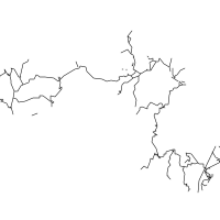
Contains information from OpenStreetMap, which is made available under the ODbL by the OpenStreetMap Foundation. This includes the route geometry, the waypoints, and the road network drawn behind the route at the top of this page.
© OpenStreetMap contributors, ODbL.